SBB for Komoot
Bridging SBB with Komoot for lazy hikers.
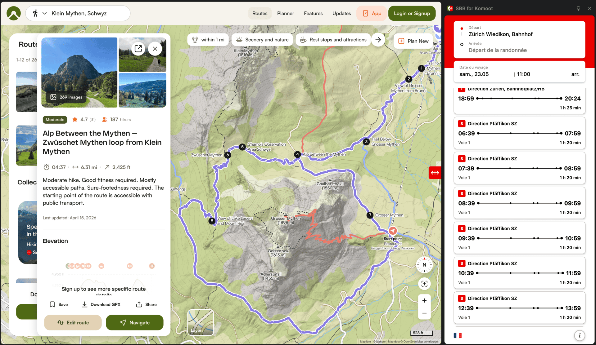
Browser extension adding SBB/CFF/FFS (Swiss Federal Railways) route planning to Komoot, published for both Firefox and Chrome.
- Developed with Aloha Churchill for our shared hikes
- Built using extensions.js for cross-browser compatibility
- Published on both Firefox Add-ons and Chrome Web Store
 Open project